

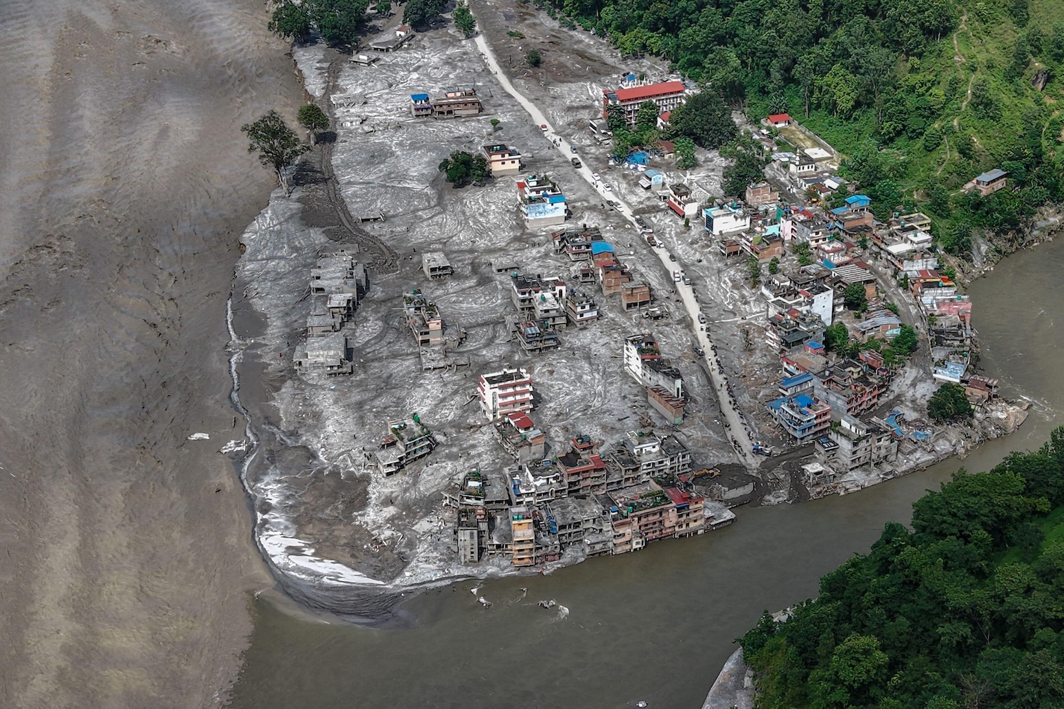
A major disaster struck the Himalayan border region of Nepal and Chinese Tibet on 26 August when a bedrock collapse and glacial mass broke away from Langtang-Lirung mountain at approximately 5,200 metres elevation. The cascading event sent rock, ice, water and debris down the mountainside into the Lhende Khola river valley, generating a wall of water that traveled downstream at speeds reaching 30 kilometres per hour. The initial floodwave killed more than 1,300 people and caused widespread destruction across settlements in both Nepal and Tibet, with property losses estimated at $2.5 billion.
Initial reports attributed the disaster primarily to glacial collapse, but further analysis by the HiRisk scientific consortium and other researchers revealed a more complex “multi-hazard cascade.” Satellite imagery and expert analysis showed that bedrock beneath the glacier had failed mechanically, causing the overlying glacier to collapse as well. The impact registered as magnitude 5.2 on seismic instruments. A secondary surge occurred when a barrier lake formed where two rivers converge in Tibet burst on 28 August, sending additional floodwaters downstream and demonstrating the ongoing cascade of impacts from the initial event.
The scientific community has cautioned against simplistic explanations of the trigger mechanism. Experts note that while the immediate cause appears to be mechanical failure of rock material from accumulated stress, no formal attribution study has been conducted to establish climate change’s specific role. However, researchers have identified warming temperatures, glacier retreat and permafrost thaw as potential contributing factors that may have increased vulnerability to such events. Scientists emphasize that rapid warming in Asia’s high mountains is fundamentally reshaping the region’s landscape, making ice-rock avalanches increasingly common in areas experiencing rapid glacier loss.
Article Attribution | Read More at Article Source
Article summary produced by Claude AI