

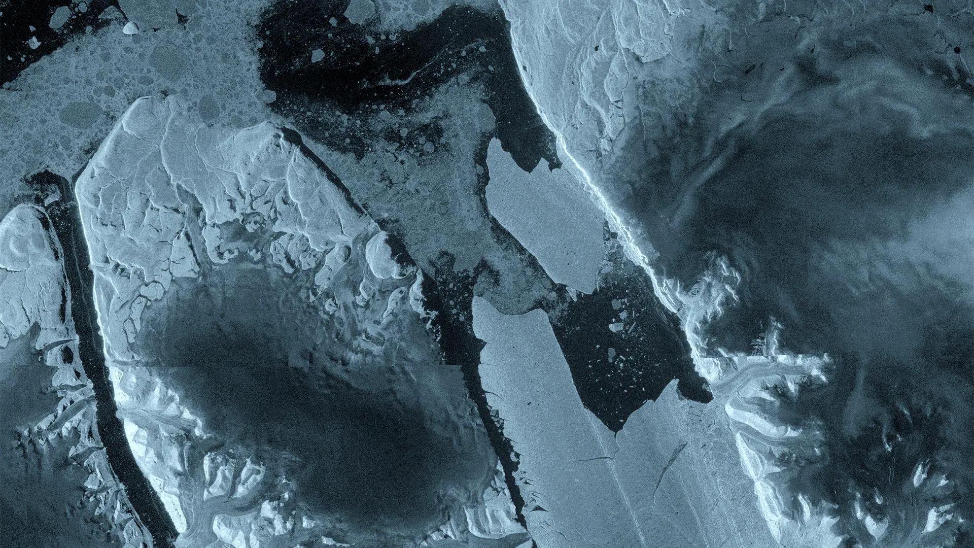
Europe’s Copernicus Sentinel-1 satellite mission has documented a significant calving event at Petermann Glacier in northwest Greenland, where a 76 square kilometer section of floating ice separated from the glacier on August 4, 2026. The newly formed tabular iceberg, comparable in size to Manhattan and potentially as thick as 150 meters, represents the glacier’s most substantial loss of floating ice since 2012 and the largest Arctic calving event recorded in six years.
Radar imagery from Sentinel-1 captured the deterioration process, showing significant structural weakening along the ice tongue’s center on August 3, with complete separation occurring within a single day. The satellite’s radar instruments proved particularly valuable for monitoring this remote glacier, as they can operate through darkness and cloud cover. An international research team from Canadian and British universities has been tracking Petermann Glacier since 2019 through ESA’s FutureEO ARCTEX project, documenting the expansion of fractures and signs of instability months before the calving event occurred. Interferometric observations from April had already revealed deformation within the floating ice tongue, providing researchers early warning of the impending break.
Petermann Glacier has a history of major calving events, having produced large ice islands in 2008, 2010, and 2012, though the floating ice tongue had remained relatively stable since 2012 aside from smaller events. Researchers indicate that additional ice islands with areas of approximately 97 and 87 square kilometers may eventually detach as existing rifts continue spreading across the glacier’s floating section.
The calving event carries practical implications beyond scientific interest. Environment and Climate Change Canada is monitoring the iceberg’s trajectory to assess potential risks to Arctic shipping routes and offshore infrastructure. Ice masses of this magnitude can persist in ocean waters for extended periods while gradually fragmenting into smaller pieces that become increasingly difficult to track. Scientists plan to continue observing both the glacier and the newly formed ice island using satellite data, aerial surveys, and tracking technology to better understand Arctic ice island behavior and the broader processes driving glacial changes in polar regions.
Article Attribution | Read More at Article Source
Article summary produced by Claude AI