

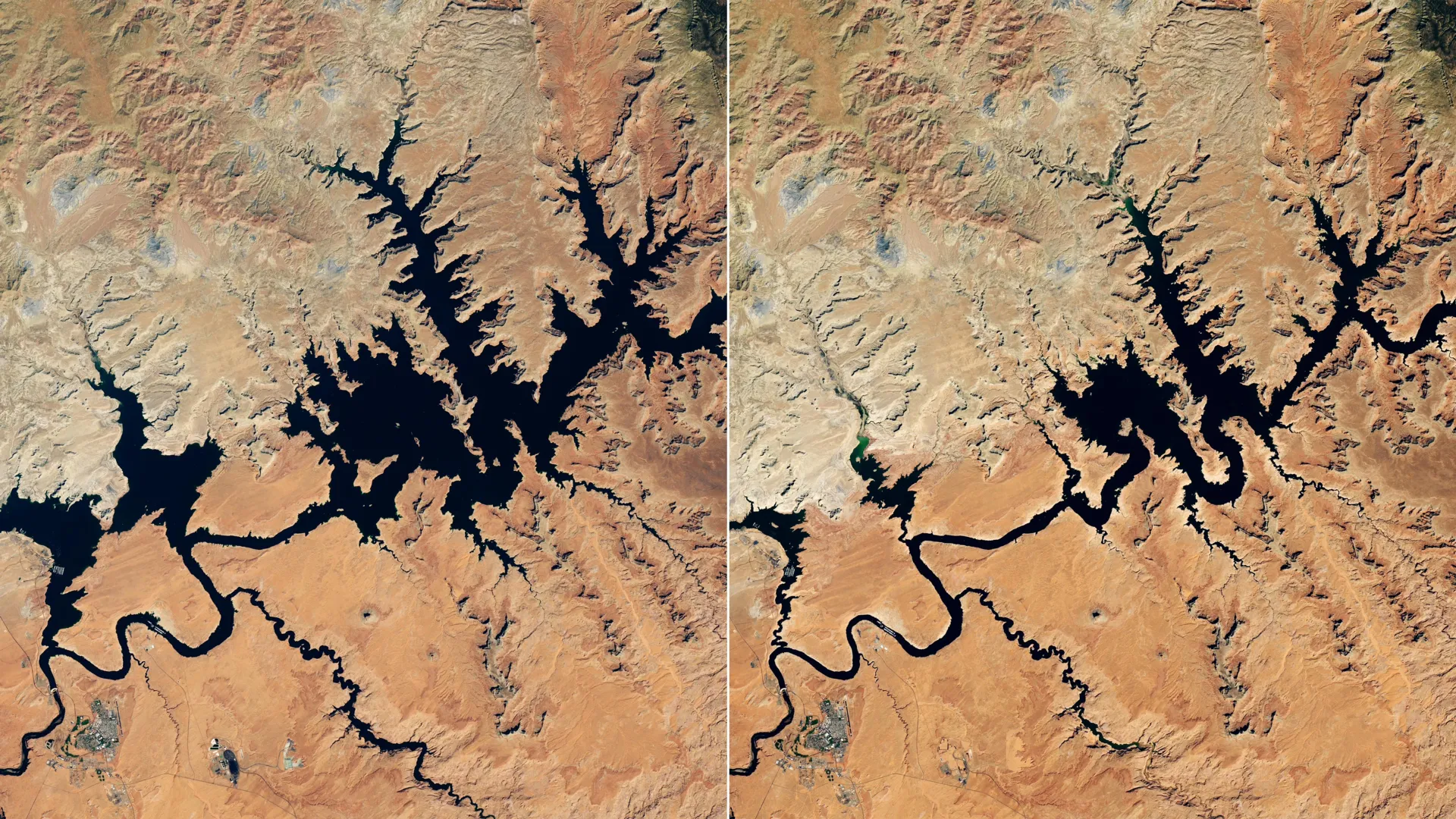
A combination of weak mountain snowpack and unusually warm temperatures across the Colorado Basin sharply curtailed water inflows to major reservoirs throughout the American West during 2026. The Upper Colorado Basin’s reduced snowmelt, resulting from both a winter snow drought and periods of record warmth, left Lake Powell with significantly depleted water supplies by summer months.
Lake Powell’s water surface fell to 3,517.24 feet on September 10, dropping below its previous record low of 3,519.92 feet set on April 13, 2023. The reservoir, the nation’s second-largest, continued declining into early September. Satellite imagery documented the dramatic visual change in the lake near Glen Canyon Dam. Lake Mead, which receives Colorado River water downstream from Lake Powell, also reached record-low levels during August.
The Colorado River system serves as a vital resource for more than 40 million people across the Southwest, including residents of major metropolitan areas such as Las Vegas, Phoenix, Los Angeles, and San Diego. The river additionally supplies irrigation water to approximately 5 million acres of agricultural land. Because much of the Colorado Basin consists of arid and semi-arid terrain, winter snowpack accumulation at high elevations plays a critical role in the river’s annual flow generation.
Facing potential operational challenges, the Bureau of Reclamation implemented emergency measures beginning in April 2026 to prevent Lake Powell from falling below minimum levels required for hydroelectric power generation. The agency released additional water from Flaming Gorge Reservoir while reducing releases from Lake Powell to Lake Mead. Officials also canceled planned environmental restoration efforts, including a controlled flood designed to rebuild fish habitat and a targeted water release intended to protect native species.
The Southwest has experienced persistent drought conditions since approximately the beginning of the 21st century, with experts characterizing the prolonged dry period as a megadrought. NASA-supported monitoring systems and satellite data tools provide regional water managers with detailed information on evolving drought conditions, helping inform decision-making across the Colorado River Basin.
Article Attribution | Read More at Article Source
Article summary produced by Claude AI