

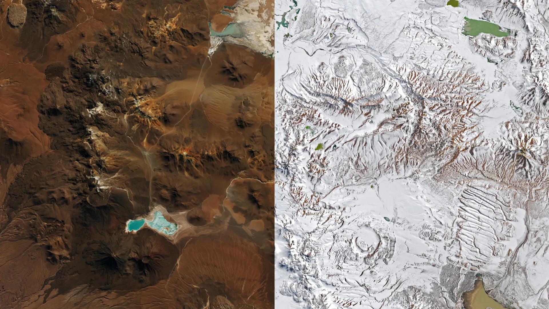
A series of winter weather systems moved across northern Chile during August 2026, delivering snow to portions of the Atacama Desert, one of Earth’s driest regions. While snowfall in this area is not completely uncommon—similar events occurred in 2025 and 2011—the scope and reach of the late August storm proved particularly noteworthy. Satellite imagery from NASA’s Landsat and Terra satellites captured the transformation, documenting snow coverage that extended from the high Andes plateau westward across the hyperarid core of the Atacama and toward the Pacific coastline south of Antofagasta. The Chajnantor plateau, which hosts the Atacama Large Millimeter/submillimeter Array radio telescope, received heavy snowfall accompanied by strong winds, prompting the facility to suspend operations and secure its equipment.
Atmospheric scientists attributed the unusual weather pattern to a cutoff low-pressure system that separated from the jet stream, combined with an exceptionally large trough spanning much of the Southern Hemisphere. René Garreaud, an atmospheric scientist at the University of Chile, noted that this particular storm developed under circumstances more unusual than comparable events. The convergence of the disrupted pressure pattern with abundant coastal moisture generated precipitation across an exceptionally broad geographic area, with rain and snow falling simultaneously in offshore regions, along the coast, across the desert interior, and over the mountains.
The precipitation delivered extreme rainfall amounts to some areas. The city of Taltal recorded approximately 40 millimeters of rain over three days, representing roughly ten times its typical annual precipitation. The intense weather triggered mudflows and flash flooding across northern Chile, with the National Disaster Prevention and Response Service reporting thousands of affected residents and hundreds of homes sustaining major damage. According to Garreaud, precipitation totals reached levels “rarely seen in the otherwise extremely arid region,” with such significant events occurring only a few times per decade or less frequently.
Experts pointed to strengthening El Niño conditions as a key factor enabling the unusually wet winter pattern across north-central Chile. During El Niño episodes, the subtropical Pacific high-pressure system that normally maintains dry conditions weakens, while a blocking high becomes more likely to develop over the South Pacific. These atmospheric shifts redirect the Southern Hemisphere storm track closer to the equator, facilitating the movement of powerful weather systems into areas that typically remain extremely dry throughout the year.
Article Attribution | Read More at Article Source
Article summary produced by Claude AI