

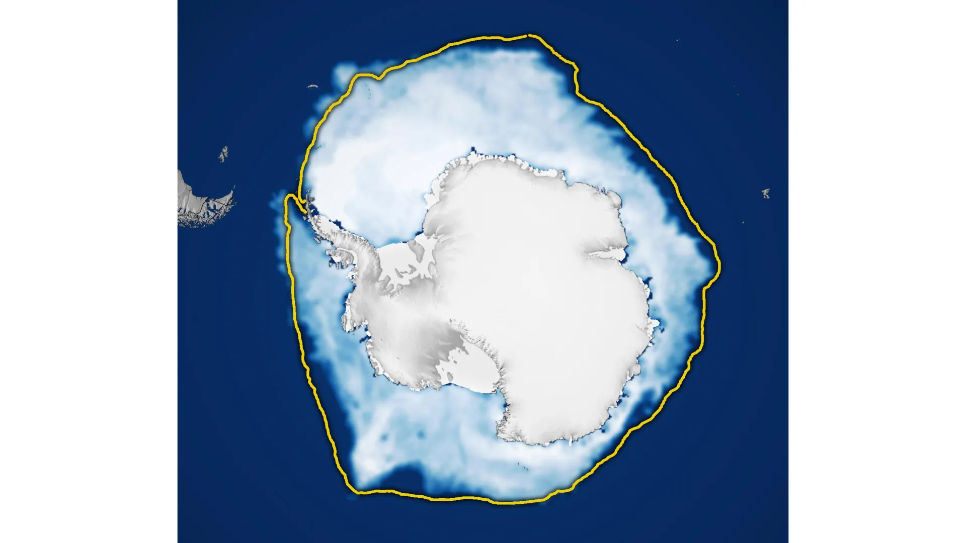
Antarctic sea ice attained its annual winter peak in September 2026, covering approximately 17.59 million square kilometers. This maximum extent marked the third lowest measurement since satellite observations began in the late 1970s, underscoring a significant transformation in the region’s frozen waters.
For much of the satellite record, Antarctic sea ice exhibited an upward trend that contrasted sharply with declining Arctic ice. Between 1979 and 2014, coverage increased by roughly 1 percent per decade, with particularly notable growth occurring from 2012 to 2014, when three consecutive winter records were set. However, this expansion halted abruptly in 2015. Starting in 2016, the region entered a period of substantial ice loss, marking a striking reversal from the previous decades of growth. While occasional years have shown modest recoveries, Antarctic sea ice has generally remained below its historical average since this shift occurred.
The most severe conditions materialized in 2023, when Antarctica experienced both its lowest summer minimum and its lowest winter maximum in the satellite record. The latest measurements from 2026 continue this downward trajectory. Scientists are actively monitoring annual changes to determine whether these declines represent a permanent shift in Antarctic sea ice dynamics or reflect natural variability within the system.
Observations are conducted using passive microwave sensors aboard satellites, which detect naturally emitted microwave energy rather than relying on visible light. This technology allows researchers to measure ice extent even through cloud cover. The monitoring program began with NASA’s Nimbus-7 spacecraft in late 1978 and has expanded to include data from multiple satellite systems over subsequent decades. As of 2025, researchers integrated observations from Japan’s GCOM-W satellite to maintain continuity of the long-term record.
Article Attribution | Read More at Article Source
Article summary produced by Claude AI